UAV Documentation
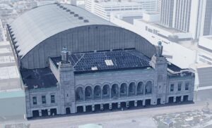
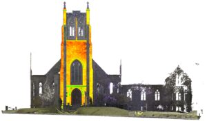
UAV documentation offers a safe and efficient means of collecting data in challenging or difficult-to-access locations. Using high-resolution drone imagery, we produce orthomosaics, 3D models of existing conditions, and conduct detailed visual inspections. Additionally, infrared thermography may be employed to detect water infiltration in roofs and facades. All UAV operations are performed by FAA-licensed pilots, ensuring both accuracy and regulatory compliance.
[smartslider3 slider=”11″]