FAA Proposes Remote ID Rule for Drones

Patrick Capruso piloting a UAS as part of a conditions assessment of The Basilica of St. Lawrence in Asheville, NC

In late December, the Federal Aviation Administration announced a proposed rule for the remote identification of drones, a step considered by the agency to be critical in achieving the full integration of Unmanned Aerial Systems (UAS) into the national air space.

The proposed rule would require almost all UAS weighing more than 0.55 pounds to be able to broadcast their identity and location directly from the aircraft and/or transmit that information via internet link from takeoff to landing to an FAA-approved third party service provider, allowing law enforcement agencies and the public access to real-time information about where drones are flying. Manufacturers would have up to two years to make sure their products meet the performance requirements, and operators would have up to three years from the rule’s effective date to comply. It’s estimated that most unmanned aircraft currently available to consumers could be made compliant via software updates.

According to the FAA, remote identification is a step towards enabling the safe authorization of flights over people and moving vehicles as well as flights beyond visual line of sight, both of which are necessary for full-scale implementation of drone deliveries, emergency response support, and infrastructure inspection.

The public comment period for the proposed rule is open through March 2, 2020.

Helping to Write the Book on UAS Best Practices

Published in November 2019 by CRC Press, Applications of Small Unmanned Aircraft Systems: Best Practices and Case Studies presents case studies for UAS-enabled applications across a range of disciplines. Drones have made established technologies like photogrammetry, aerial imaging, and mapping affordable and accessible. Now, early adopters are sharing their expertise, allowing researchers, governments, and businesses to fully understand what is possible and to envision new UAS applications.

Kristen Olson wrote about Vertical Access’s work at the Soldiers’ and Sailors’ Memorial Monument in her contribution to chapter 9, “Small Unmanned Aerial Systems (sUAS) and Structure from Motion for Identifying, Documenting, and Monitoring Cultural and Natural Resources”. VA used multiple means of access to gather information about the exterior and interior of the monument, including UAS to document existing conditions at inaccessible interior spaces. Kristen co-presented on this case study at the National Center for Preservation Training and Technology Digital Documentation Summit in New Orleans in 2017 along with Douglas Gonzalez of Leslie E. Robertson Associates.

Click here to read more about our work at the Soldiers’ and Sailors’ Monument and click here to purchase the book in hardcover or ebook formats.

A Visit from St. Nicholas?

‘Twas the month before Christmas, Thanksgiving weekend 
On a campus deserted, but lo! There ascends
We know not yet which – sleigh, climber, or drone
To place upon high a garment on loan
From a jolly old elf: a hat red and white;
A mischievous prank under cover of night…

Exactly 22 years and 58 days after one of the most famous pranks in the history of the Ivy League, another mysterious object appeared atop Cornell University’s McGraw Tower on Sunday, December 1. This time, instead of a hollow gourd, it was a Santa hat. No one has come forward to claim responsibility for the caper, and the perpetrators’ means of access is unknown. 

A swirl of questions surrounded the pumpkin, after it was discovered on the morning of October 8, 1997. Speculators wondered whether it was real and pondered how anyone had managed to impale it at the top of a steeply-sloping metal roof. Student scientists competed to obtain a sample of the object to confirm that it was, indeed, a pumpkin. And finally, after enduring five months of winter conditions, the shriveled fruit was removed with a crane. To this day, the pranksters have not revealed their identities (Vertical Access was not involved). 

Unlike the pumpkin, the hat has disappeared just as quietly as it appeared. Did a certain toymaker reclaim his cap? Did the wind blow it down? Why didn’t they call VA? We may never know.

While Vertical Access had nothing to do with the placement of the hat – “my alibi is rock-solid,” says Founding Partner Kent Diebolt [Cornell ‘82] – we stand at the ready to put our expertise to work in accessing, documenting, or removing the next object to appear atop McGraw Tower.

LAANC is Here: Near-Realtime Airspace Authorization

The biggest obstacle to utilizing UAVs for building documentation has been the prohibition on flying within restricted airspace surrounding airports. Since 2016, authorization to operate in this airspace has depended on case-by-case review by the Federal Aviation Administration with a typical lead time of at least 90 days. By 2018, the backlog for reviewing airspace authorization requests had grown to 6 months or longer.

Shown here is Kristen Olson surveying Springfield, MA’s Campanile clock tower with a drone for Bruner/Cott Architects. We are assisting with a wide range of discovery phase tasks as part of the Springfield Campanile Restoration and the drone is one tool helping us provide a complete picture.

Beginning earlier this year, the FAA made available a new system for requesting authorization to operate UAVs within restricted airspace, called LAANC, or Low Altitude Authorization and Notification Capability. LAANC is a partnership between the FAA and third-party providers such as AirMap and Skyward, who have developed app-based platforms to allow UAV pilots to apply for and obtain airspace authorization in near-real time. LAANC was rolled out over a period of six months, and as of September 13, all of the regions in the US are on-line, although not all airports are participating as of this time.

The LAANC concept is based on maps showing predetermined maximum flight altitudes in a grid pattern surrounding an airport. While flights very close to airports are still off-limits (or will require a more rigorous application and vetting process), the LAANC system greatly expands the possibilities for UAVs to gather valuable information about buildings and structures in U.S. cities. To put it in perspective, more than half of the downtown areas of Albany, Boston, Baton Rouge, Phoenix, Salt Lake City, and Kansas City (to name just a few) were effectively off-limits to commercial UAV flight prior to LAANC.

The next development, still years away, will be a system developed by the FAA and NASA to fully integrate low-altitude flight into the national airspace.


For more on LAANCE, visit: https://www.faa.gov/uas/programs_partnerships/uas_data_exchange/


Photogrammetry with Drones, Rope Access, and TPAS®

Photogrammetry is the practice of extrapolating spatial relationships from photographic imagery. While the concept of photogrammetry is centuries old, today’s powerful software quickly generates a 3-dimensional point cloud of any scene or object captured with a half dozen or up to several hundred overlapping digital photographs. Two recent projects illustrate very different applications for this technology in expanding what Vertical Access can do for clients in hard to reach areas.

Using Unmanned Aerial Vehicles for Conditions Documentation and Image Capture

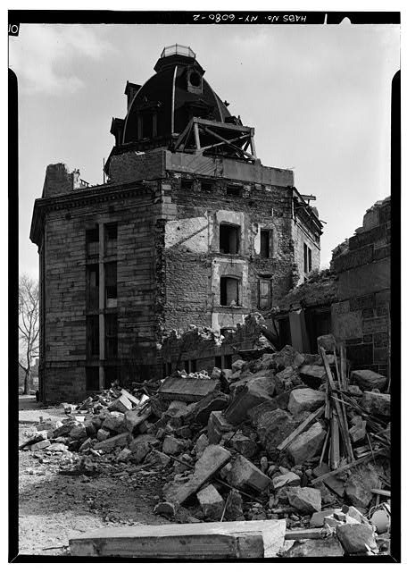
Work on existing structures begins with accurate as-built documentation. But what if there is no background drawing on file for use in the field?

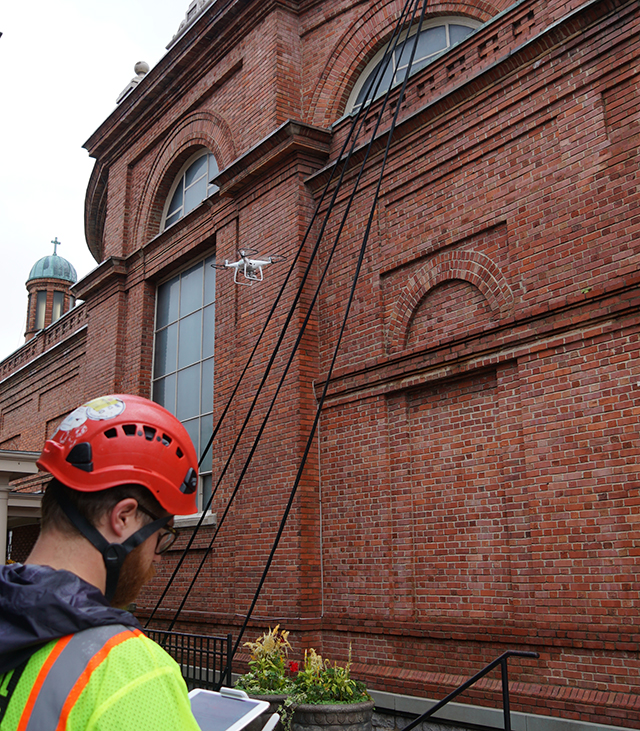
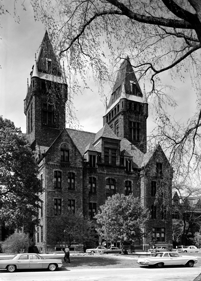
Enter photogrammetry. On a recent project, the main façade of a building could not be surveyed with an aerial lift due to site features, leading the project team to investigate the use of an unmanned aerial vehicle (drone) to capture close-range imagery of the façade conditions as well as photographs for use in the creation of scaled, detailed background drawings.

Vertical Access’ licensed drone pilots operated a DJI Phantom 2 drone to obtain medium-range imagery for the creation of a photogrammetric 3D point cloud, as well as close-range 4K video for the conditions documentation of the structure. The field work was accomplished by a team of two pilots in less than two days and required only partial closure of the pedestrian walkway to safely conduct the drone flights.

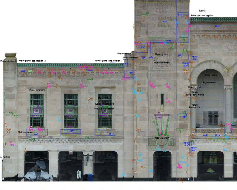
2D elevations generated from the 3D model annotated with fault conditions in AutoCAD. Fault conditions such as cracks, spalls, and displaced masonry units were annotated digitally using the Tablet PC Annotation System (TPAS®).

Back in the office, VA used Pix4D Mapper Pro photogrammetry software to generate the point cloud, textured mesh, and 2D orthoimages of the main façade, side wings, and tower returns. The orthoimages were scaled and placed as background images in an AutoCAD drawing, and fault conditions such as cracks, spalls, and displaced masonry units were annotated digitally using the Tablet PC Annotation System (TPAS®). Condition quantities were extracted from the AutoCAD drawing into an Excel spreadsheet to facilitate repair cost estimates.

A close-range visual inspection as well as image capture for photogrammetry were completed in much less time than it would have taken to inspect the façades and obtain hand measurements using an aerial lift. The field work was accomplished with minimal disruption to pedestrians.

Deliverables from this study include a scaled 3D point cloud and textured mesh, 3D PDF model, background drawings based on orthoimages generated from the photogrammetric point cloud, and 4K video documenting façade conditions at close range, with over 800 video stills hyperlinked to conditions annotations in the AutoCAD elevation drawings.

Modeling Decorative Features of Historic Structures With Photogrammetry

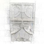
A 3D3D photogrammetric models of an individual terra cotta unit, to be transformed into shop drawings for replacement units.

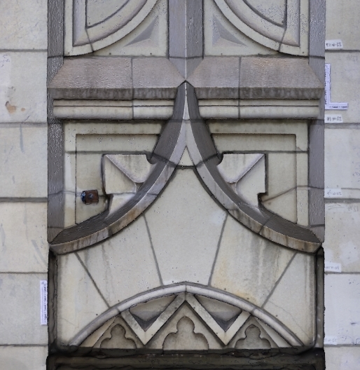
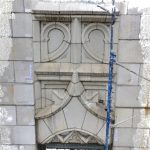
Restoration of historic decorative terra cotta, cast stone, or natural stone often requires extensive replacement of individual units. Erecting scaffolding for hands-on access to measure and remove existing units adds significant cost to project budgets.

Vertical Access recently used photogrammetry to aid in a pilot project as an alternative option for acquiring dimensions of existing units.

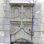
Vertical Access photographed a terra cotta spandrel panel and parapet, using existing scaffolding to gain hands-on and close-range access. The photographs were used to create 3D photogrammetric models of individual units, to be transformed into shop drawings for replacement units.

With VA’s demonstrated rope access capability, units can be photographed and modeled without the need for scaffolding, yielding a cost savings for the building owner.

Announcing the TPAS 2017 Release Webinar

TPAS 2017 is here! Join TPAS LLC and Vertical Access for a live, interactive webinar on October 11 at 1pm EDT to learn about the new 2017 features as well as the basics of the Tablet PC Annotation System. Vertical Access uses TPAS for direct-to-digital surveys, saving time in the field and in the office.

Visit the TPAS Blog for more information about the 2017 release and webinar, or click here to register.

Reviving Hospitals and Asylums for the 21st Century

Abandoned hospitals and asylums may be a horror film cliche, but the statistics on vacant, threatened, and demolished institutional complexes are all too real. Search “abandoned asylum” and the first hit is an article on the popular website Atlas Obscura: “18 Abandoned Psychiatric Hospitals, and Why They Were Left Behind.” Of the hundreds of asylums built in the U.S. during the 19th and early 20th centuries, most became underused or vacant during the deinstitutionalization movement of mid-20th century. Some have been repurposed, but many more await revitalization.

Partial demolition of the New York City Lunatic Asylum. Library of Congress, call number HABS NY,31-WELFI,6–2

Psychiatric hospitals are challenging to reuse. Many of them are physical reminders of tragic chapters in the history of mental health treatment, and often include patient burials on the site. Some contain buildings that have been vacant for decades, subject to neglect and vandalism.

But there are many reasons why hospitals and asylums are historically significant and should be preserved. First and foremost, they are places of memory for understanding and recording the histories of the thousands of individuals who lived and died on their grounds. Former hospitals also serve as a record of the changing attitudes about institutionalization and treatment of mental illness in the U.S. during the 19th and 20th centuries. And, many are recognized as works by master designers and as examples of the prevailing architectural styles of their times. Tuberculosis sanatoriums, smallpox hospitals, and soldiers’ homes are among other institutional building types sharing some of the same challenges and opportunities for adaptive use as asylums.

The Richardson Olmsted Complex in 1965. Photo by Jack E. Boucher. Library of Congress, call number HABS NY,15-BUF,9-1

These complexes also contain durable building stock representing a significant amount of embodied energy. Many of the sprawling campuses were designed to be self-sufficient farms, so they have plenty of room for sensitive infill or new construction to meet accessibility standardizing. Buildings on the campus of the Richardson Olmsted Complex (formerly the Buffalo State Asylum for the Insane and now a National Historic Landmark) have been reborn as Hotel Henry and the Lipsey Buffalo Architecture Center, while other buildings have been stabilized for future renovation. The campus recently hosted enLIGHTen, an outdoor concert by the Buffalo Philharmonic Orchestra with a custom-designed light show projected onto the H.H. Richardson-designed main building.


Binghamton’s “Castle on the Hill”
By Kfbill08 – Own work, CC BY-SA 3.0, https://commons.wikimedia.org/w/index.php?curid=11013391

Closer to our home office in Ithaca, the former New York State Inebriate Asylum in Binghamton (now also known as the “Castle on the Hill”) is a National Historic Landmark awaiting rehabilitation. It was chartered in 1854 as the first facility in the U.S. to treat alcoholism as a medical illness, but was converted to a mental hospital in the 1870s. Plans were announced in 2008 for SUNY Upstate Medical University to revitalize the complex, but the project was abandoned during the recession. In 2015, Binghamton University took over stewardship of the property, and exterior work is expected to begin in early 2018.

Vertical Access on site at the St. Elizabeths West Campus, U.S. General Services Administration. Photo by Vertical Access.

Another large campus currently undergoing long-term revitalization is the 346-acre St. Elizabeths in Washington, D.C. (also a National Historic Landmark), where Vertical Access recently completed a smokestack investigation working with Atkinson-Noland & Associates and Goody Clancy. The multi-phase project includes repurposing some existing buildings, mothballing others, and adding new construction in order to house the United States Department of Homeland Security and other federal agencies. Architecture of an Asylum: St. Elizabeths 1852-2017 is on exhibition at the National Building Museum in Washington D.C through January 15, 2018.


Historic Ithaca Executive Director Search

Historic Ithaca is seeking candidates for the position of Executive Director. Established in 1966 as a community response to threats to downtown Ithaca landmarks, HI is the non-profit voice for preservation in Tompkins County and the Finger Lakes Region.  The new ED will join an exceptional team of staff, board members, and volunteers promoting the values of historic preservation and livable communities throughout Tompkins County. From job training and architectural salvage to grassroots advocacy, technical services, and educational events, Historic Ithaca makes a big impact in our community. Click here for details on the job posting and to learn more about HI’s work.